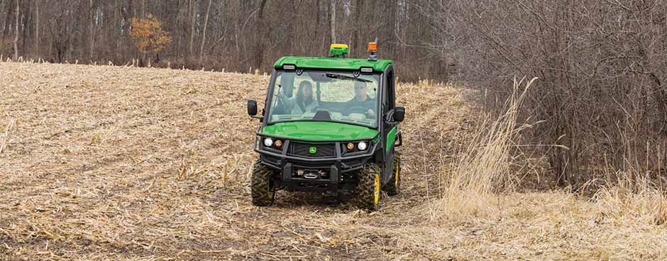
With our Boundary Mapping Programs, you will be able to utilize a TRULAND-supplied 835M Gator™ and Precision Ag Equipment to ensure fields are mapped and uploaded into John Deere Operations Center. After you decide which program is best for you, please reach out and our precision ag support team will help facilitate any questions or details.
Full-Service Boundary Program
All boundaries are driven with the assistance of a TRULAND Precision Ag team member. A Precision Ag team member will also assist customers with pre and post Operations Center work to ensure field names are correctly loaded into the display and boundaries are properly uploaded to Operations Center.
$2.50/ACRE (500 ACRE MINIMUM) | PRICE PER ACRE OF RECORDED BOUNDARY
- Customer is responsible for any damages to trailer and/or Gator.
- Customer is responsible for accurate boundaries to avoid equipment obstacles.
Limited Assistance Boundary Program
Customers would receive assistance with pre- and Post-Operations Center work to ensure field names are correctly loaded into the display and boundaries are properly uploaded to their Operations Center. The customer will also receive assistance with up to 3 fields for Boundary Recording Training. After the training is completed, the customer is responsible for completing the remaining fields independently.
$1.50/ACRE (500 ACRE MINIMUM) | PRICE PER ACRE OF RECORDED BOUNDARY
- Customer is responsible for any damages to trailer and/or Gator.
- Customer is responsible for accurate boundaries to avoid equipment obstacles.
Why Maintaining and Updating Boundaries is Important
Section Control and ExactEmerge/ExactApply
- Inaccurate boundaries can turn off single rows or nozzles
Work Planner and Field Detection on Gen4 and G5 displays
- Inaccurate boundaries lead to work plans trying to change when*in field
AutoTrac Turn Automation
- Inconsistent boundaries lead to variable headland offsets.
AutoPath from Boundaries
- If your boundaries are kept updated, you now can create AutoPath files from accurate boundaries.
Autonomy
- Keeping accurate boundaries is important because Autonomy is coming! This step is key to future changes with technology.